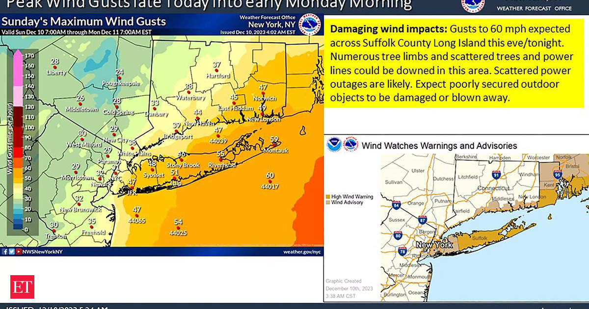
A bomb cyclone is set to hit the East Coast, bringing intense gale-force winds, heavy rains, and the potential for flooding. The storm, which originated from Florida and Georgia, is expected to impact areas including New York City, Pennsylvania, and New Jersey. The National Weather Service has issued a wind advisory for over 32 million Americans, with winds ranging between 40 and 70 mph along the coast. Up to 4 inches of rainfall is forecasted for a stretch from North Carolina to Maine. Flood watches have been issued for Washington and Baltimore. New York City officials have warned commuters to prepare for disrupted travel conditions as the storm is expected to cause heavy winds and major flooding. Rivers in Pennsylvania, New Jersey, New York, and a considerable portion of New England are at risk of flooding on Monday and Tuesday. The National Weather Service also cautions about dangerous marine conditions extending into early next week. As the storm progresses, winds and seas are anticipated to gradually subside. Winter Hurricane, commonly known as a bomb cyclone, is characterized by intense cyclonic winds and intense precipitation. It is formed when there is a rapid drop in atmospheric pressure. This weather event poses risks such as heavy rains, high winds, and the potential for flooding. The National Weather Service advises residents in the affected areas to stay updated on weather conditions and take necessary precautions. In conclusion, a bomb cyclone is advancing towards the East Coast, expected to bring heavy rains, high-speed winds, and the potential for flooding to areas including New York City, Pennsylvania, and New Jersey. Commuters and residents are advised to stay updated on weather conditions and prepare for disrupted travel conditions.
US Weather Forecast Predicts Bomb Cyclone to Hit New York City and Surrounding Areas

-
Uncategorized


